

A digital tool to highlight long-term trends in coastal erosion and growth has been launched by Geoscience Australia’s Digital Earth Australia (DEA) program.
The tool was developed with input from local councils, state governments, academia and citizen scientists, and will provide scientists, managers, and planners with the means to reliably assess impacts to Australia’s coastlines and to maintain and protect them for future generations.
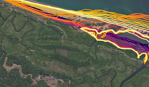
The DEA Coastlines tool uses satellite imagery collected since 1988 to show the evolution of Australia’s coastlines in “unprecedented scale and detail”.
Geoscience Australia branch head Maree Wilson said: “Australia has a highly dynamic coastline of over 30,000km with many unique environments such as sandy beaches, rocky cliffs, muddy tidal flats, and mangroves.
“DEA Coastlines is the first nationally consistent dataset within Australia that tracks these changing shorelines.
“Understanding how our coastal environments have been historically affected by pressures such as extreme weather, sea-level rise, and human development is vital to managing our coastlines now and into the future,” Ms Wilson said.
The free online tool can also illustrate how natural coastal features like sandbanks or river mouths shift and change over time.